
尧渡镇 topographic map
Interactive map
Click on the map to display elevation.
About this map
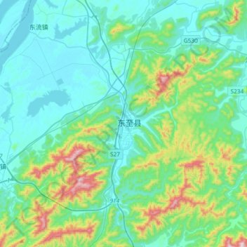
Name: 尧渡镇 topographic map, elevation, terrain.
Location: 尧渡镇, 东至县, 池州市, 安徽省, 247200, 中国 (29.98397 116.86472 30.23848 117.15649)
Average elevation: 131 m
Minimum elevation: 3 m
Maximum elevation: 675 m
Other topographic maps
Click on a map to view its topography, its elevation and its terrain.