
Qamea topographic map
Interactive map
Click on the map to display elevation.
About this map
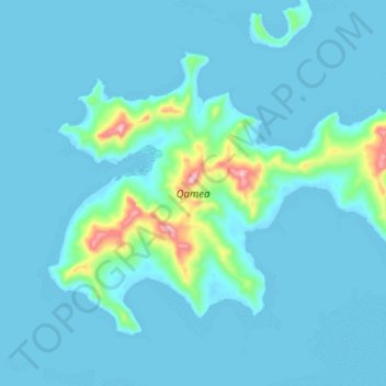
Name: Qamea topographic map, elevation, terrain.
Location: Qamea, Northern, Fiji (-16.80475 -179.80149 -16.73723 -179.70595)
Average elevation: 28 m
Minimum elevation: -3 m
Maximum elevation: 287 m
Other topographic maps
Click on a map to view its topography, its elevation and its terrain.