
Bryan topographic map
Interactive map
Click on the map to display elevation.
About this map
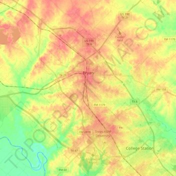
Name: Bryan topographic map, elevation, terrain.
Location: Bryan, Brazos County, Texas, États-Unis d'Amérique (30.58460 -96.45925 30.73152 -96.24589)
Average elevation: 94 m
Minimum elevation: 57 m
Maximum elevation: 123 m
Other topographic maps
Click on a map to view its topography, its elevation and its terrain.
College Station
États-Unis d'Amérique > Texas > Brazos County
College Station, Brazos County, Texas, États-Unis d'Amérique
Average elevation: 87 m