
工布江达镇 topographic map
Interactive map
Click on the map to display elevation.
About this map
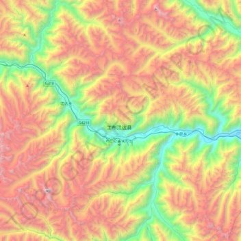
Name: 工布江达镇 topographic map, elevation, terrain.
Location: 工布江达镇, 工布江达县, 林芝市, 西藏自治区, 中国 (29.77865 93.18554 30.04194 93.64485)
Average elevation: 4,644 m
Minimum elevation: 3,307 m
Maximum elevation: 6,222 m
Other topographic maps
Click on a map to view its topography, its elevation and its terrain.