
Chadiza topographic map
Click on the map to display elevation.
Chadiza
Chadiza is a town in the Eastern Province of Zambia. Its headquarters are located in Chadiza District. It lies 35 km south of the Great East Road and about 80 km south-south-west of Chipata, on a plateau (elevation 1050 m) studded by isolated rocky hills, between the middle Luangwa valley and the Zambezi. It is also 35 kilometres north-north-east of the Chimefusa Border (the main border crossing between Mozambique and Zambia).
About this map
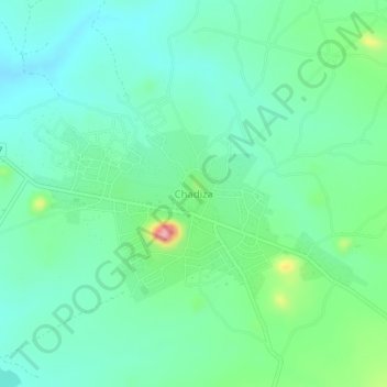
Name: Chadiza topographic map, elevation, terrain.
Location: Chadiza, Chadiza District, Eastern Province, Zambia (-14.08146 32.41453 -14.04146 32.45453)
Average elevation: 1,055 m
Minimum elevation: 1,015 m
Maximum elevation: 1,177 m
Other topographic maps
Click on a map to view its topography, its elevation and its terrain.