
調整池 topographic map
Interactive map
Click on the map to display elevation.
About this map
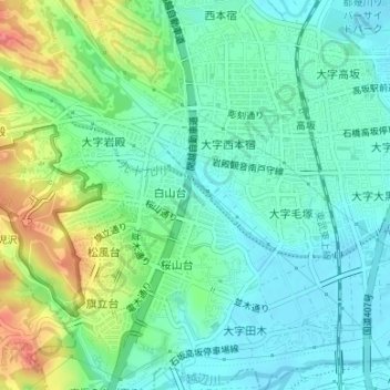
Name: 調整池 topographic map, elevation, terrain.
Location: 調整池, 白山台, 東松山市, 埼玉県, 日本 (35.99650 139.38805 35.99700 139.38851)
Average elevation: 41 m
Minimum elevation: 19 m
Maximum elevation: 89 m
Other topographic maps
Click on a map to view its topography, its elevation and its terrain.