
นาดี topographic map
Interactive map
Click on the map to display elevation.
About this map
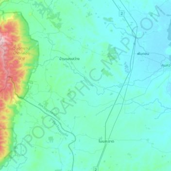
Name: นาดี topographic map, elevation, terrain.
Location: นาดี, Udon Thani, Thailand (16.91147 102.69408 17.23147 103.01408)
Average elevation: 227 m
Minimum elevation: 167 m
Maximum elevation: 663 m
Other topographic maps
Click on a map to view its topography, its elevation and its terrain.