
新城子镇 topographic map
Interactive map
Click on the map to display elevation.
About this map
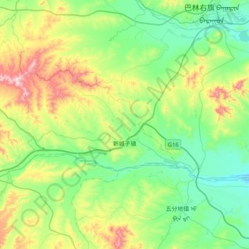
Name: 新城子镇 topographic map, elevation, terrain.
Location: 新城子镇, 林西县, 赤峰市, 内蒙古自治区, 中国 (43.24242 117.99196 43.43791 118.57624)
Average elevation: 780 m
Minimum elevation: 577 m
Maximum elevation: 1,402 m
Other topographic maps
Click on a map to view its topography, its elevation and its terrain.