
Choma topographic map
Click on the map to display elevation.
Choma
Choma lies on the Lusaka–Livingstone Road, approximately 292 kilometres (181 mi) south-west of Lusaka, the national capital and largest city in Zambia. This is approximately 194 kilometres (121 mi), by road, northeast of Livingstone, the largest city in Zambia's Southern Province. The geographical coordinates of Choma are:16°46'16.0"S, 26°59'32.0"E (Latitude:-16.771111; Longitude:26.992222). Choma sits at an average elevation of 1,337 metres (4,386 ft) above mean sea level. The Nkanga River Conservation Area lies approximately 25 kilometres (16 mi) from Choma town.
About this map
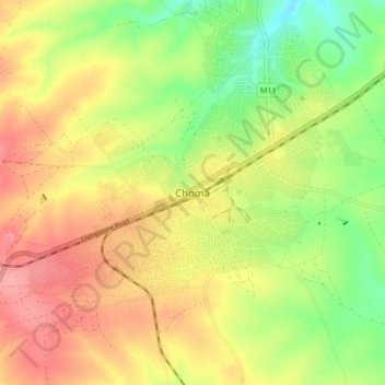
Name: Choma topographic map, elevation, terrain.
Location: Choma, Choma District, Southern Province, Zambia (-16.85419 26.93786 -16.77419 27.01786)
Average elevation: 1,310 m
Minimum elevation: 1,264 m
Maximum elevation: 1,351 m
Other topographic maps
Click on a map to view its topography, its elevation and its terrain.