
Zorita topographic map
Interactive map
Click on the map to display elevation.
About this map
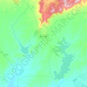
Name: Zorita topographic map, elevation, terrain.
Location: Zorita, Miajadas, Cáceres, Estrémadure, 10130, Espagne (39.17320 -5.77801 39.36931 -5.55888)
Average elevation: 407 m
Minimum elevation: 278 m
Maximum elevation: 986 m
Other topographic maps
Click on a map to view its topography, its elevation and its terrain.
Alcollarín
Espagne > Estrémadure > Miajadas
Alcollarín, Miajadas, Cáceres, Estrémadure, 10009, Espagne
Average elevation: 337 m