
Jefferson Parish topographic map
Interactive map
Click on the map to display elevation.
About this map
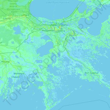
Name: Jefferson Parish topographic map, elevation, terrain.
Location: Jefferson Parish, Louisiana, USA (29.09465 -90.28068 30.23053 -89.89966)
Average elevation: 1 m
Minimum elevation: -6 m
Maximum elevation: 24 m
Other topographic maps
Click on a map to view its topography, its elevation and its terrain.
Baton Rouge
USA > Louisiana > Baton Rouge
Baton Rouge, East Baton Rouge Parish, Louisiana, USA
Average elevation: 12 m