
Lufwanyama topographic map
Interactive map
Click on the map to display elevation.
About this map
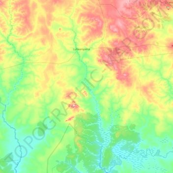
Name: Lufwanyama topographic map, elevation, terrain.
Location: Lufwanyama, Copperbelt Province, Zambia (-13.44594 27.56770 -12.62313 27.75183)
Average elevation: 1,216 m
Minimum elevation: 1,129 m
Maximum elevation: 1,414 m
Other topographic maps
Click on a map to view its topography, its elevation and its terrain.