
Thank you for supporting this site ❤️
Make a donation
Make a donation
Ndola topographic map
Click on the map to display elevation.
Thank you for supporting this site ❤️
Make a donation
Make a donation
About this map
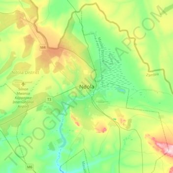
Name: Ndola topographic map, elevation, terrain.
Location: Ndola, Ndola District, Copperbelt Province, Zambia (-13.12931 28.47659 -12.80931 28.79659)
Average elevation: 1,287 m
Minimum elevation: 1,197 m
Maximum elevation: 1,485 m
Thank you for supporting this site ❤️
Make a donation
Make a donation
Other topographic maps
Click on a map to view its topography, its elevation and its terrain.