
Kabompo River topographic map
Interactive map
Click on the map to display elevation.
About this map
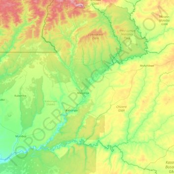
Name: Kabompo River topographic map, elevation, terrain.
Location: Kabompo River, North-Western Province, Zambia (-14.20505 23.17777 -12.51060 25.01965)
Average elevation: 1,152 m
Minimum elevation: 1,035 m
Maximum elevation: 1,512 m
Other topographic maps
Click on a map to view its topography, its elevation and its terrain.