
Milam Glacier topographic map
Interactive map
Click on the map to display elevation.
About this map
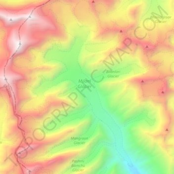
Name: Milam Glacier topographic map, elevation, terrain.
Location: Milam Glacier, Pithoragarh, Uttarakhand, India (30.45800 80.00453 30.59488 80.11819)
Average elevation: 5,223 m
Minimum elevation: 3,514 m
Maximum elevation: 7,111 m
Other topographic maps
Click on a map to view its topography, its elevation and its terrain.
Pindar Glacier
Pindar Glacier, Bageshwar, Uttarakhand, India
Average elevation: 4,447 m
Pithoragarh
India > Uttarakhand > Pithoragarh
Pithoragarh, Uttarakhand, 262500, India
Average elevation: 1,618 m