
Croydon topographic map
Interactive map
Click on the map to display elevation.
About this map
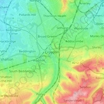
Name: Croydon topographic map, elevation, terrain.
Location: Croydon, Londen, Greater London, Engeland, CR0 1SZ, VK (51.33130 -0.14196 51.41130 -0.06196)
Average elevation: 70 m
Minimum elevation: 20 m
Maximum elevation: 175 m