
马拉 topographic map
Interactive map
Click on the map to display elevation.
About this map
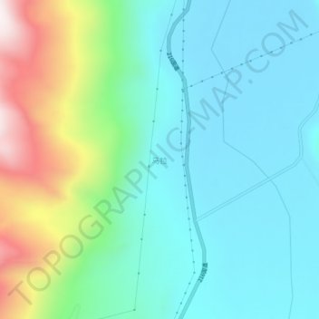
Name: 马拉 topographic map, elevation, terrain.
Location: 马拉, 吉隆县, 日喀则市, 西藏自治区, 中国 (28.93852 85.41754 28.97852 85.45754)
Average elevation: 4,876 m
Minimum elevation: 4,662 m
Maximum elevation: 5,532 m
Other topographic maps
Click on a map to view its topography, its elevation and its terrain.