
Hurricane topographic map
Interactive map
Click on the map to display elevation.
About this map
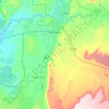
Name: Hurricane topographic map, elevation, terrain.
Location: Hurricane, Washington County, Utah, USA (37.07238 -113.44903 37.21456 -113.25564)
Average elevation: 1,154 m
Minimum elevation: 844 m
Maximum elevation: 1,781 m