
Thabet Bouzid topographic map
Interactive map
Click on the map to display elevation.
About this map
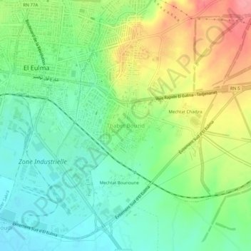
Name: Thabet Bouzid topographic map, elevation, terrain.
Location: Thabet Bouzid, El Eulma, Daïra El Eulma, Sétif, 19600, Algérie (36.12371 5.68879 36.16371 5.72879)
Average elevation: 964 m
Minimum elevation: 929 m
Maximum elevation: 1,021 m
Other topographic maps
Click on a map to view its topography, its elevation and its terrain.
Cité Houari Boumedien
Algérie > Sétif > Daïra El Eulma > El Eulma > Cité Houari Boumedien
Cité Houari Boumedien, El Eulma, Daïra El Eulma, Sétif, 19605, Algérie
Average elevation: 966 m