
Strümp topographic map
Interactive map
Click on the map to display elevation.
About this map
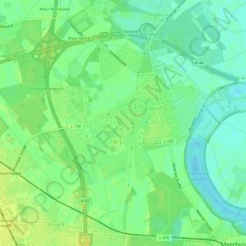
Name: Strümp topographic map, elevation, terrain.
Average elevation: 35 m
Minimum elevation: 26 m
Maximum elevation: 45 m
Das gesamte Ortsgebiet liegt auf einer Flussterrasse des Niederrheines (Niederrheinische Bucht) und ist sehr flach. Der sogenannte „Strümper Berg“ ist kaum merklich höher als das Umland.