
Mishima topographic map
Interactive map
Click on the map to display elevation.
About this map
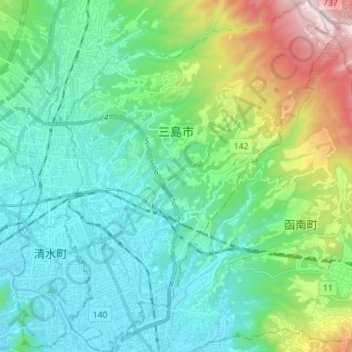
Name: Mishima topographic map, elevation, terrain.
Location: Mishima, Préfecture de Shizuoka, Japon (35.07547 138.90441 35.18980 139.01383)
Average elevation: 217 m
Minimum elevation: 0 m
Maximum elevation: 929 m
Other topographic maps
Click on a map to view its topography, its elevation and its terrain.
沼津市
Japon > Préfecture de Shizuoka > 沼津市
沼津市, Numazu, Préfecture de Shizuoka, 410-0832, Japon
Average elevation: 268 m