
Pine City Township topographic map
Interactive map
Click on the map to display elevation.
About this map
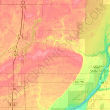
Name: Pine City Township topographic map, elevation, terrain.
Average elevation: 284 m
Minimum elevation: 235 m
Maximum elevation: 314 m
Other topographic maps
Click on a map to view its topography, its elevation and its terrain.
Rutledge
United States > Minnesota > Pine County
Rutledge, Pine County, Minnesota, United States
Average elevation: 316 m
Devils Lake
United States > Minnesota > Pine County > Pine City > Pine Terrace Mobile Home Park
Devils Lake, Pine Terrace Mobile Home Park, Pine City, Pine County, Minnesota, United States
Average elevation: 295 m
Rock Creek
United States > Minnesota > Pine County
Rock Creek, Pine County, Minnesota, United States
Average elevation: 285 m
Sturgeon Lake
United States > Minnesota > Pine County
Sturgeon Lake, Pine County, Minnesota, 55783, United States
Average elevation: 325 m
Kerrick
United States > Minnesota > Pine County
Kerrick, Pine County, Minnesota, United States
Average elevation: 357 m
Chengwatana State Forest
United States > Minnesota > Pine County > Rock Creek
Chengwatana State Forest, Rock Creek, Town of West Marshland, Pine County, Minnesota, United States
Average elevation: 282 m
Beroun
United States > Minnesota > Pine County
Beroun, Pine County, Minnesota, United States
Average elevation: 296 m
Banning State Park
United States > Minnesota > Pine County
Banning State Park, Pine County, Minnesota, United States
Average elevation: 338 m
Pine City
United States > Minnesota > Pine County
Pine City, Pine County, Minnesota, United States
Average elevation: 292 m
Finlayson
United States > Minnesota > Pine County > Finlayson
Finlayson, Pine County, Minnesota, United States
Average elevation: 339 m
Duquette
United States > Minnesota > Pine County > Duquette
Duquette, Pine County, Minnesota, 55756, United States
Average elevation: 351 m
Willow River
United States > Minnesota > Pine County
Willow River, Pine County, Minnesota, United States
Average elevation: 319 m
Brook Park
United States > Minnesota > Pine County
Brook Park, Pine County, Minnesota, United States
Average elevation: 312 m
Sandstone
United States > Minnesota > Pine County
Sandstone, Pine County, Minnesota, United States
Average elevation: 332 m
Hinckley
United States > Minnesota > Pine County
Hinckley, Pine County, Minnesota, United States
Average elevation: 315 m