
Hoengseong-gun topographic map
Interactive map
Click on the map to display elevation.
About this map
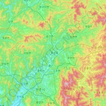
Name: Hoengseong-gun topographic map, elevation, terrain.
Location: Hoengseong-gun, Gangwon-do, 25200, South Korea (37.29826 127.75966 37.68084 128.30232)
Average elevation: 366 m
Minimum elevation: 47 m
Maximum elevation: 1,232 m
Other topographic maps
Click on a map to view its topography, its elevation and its terrain.
Gangwon
South Korea > Gangwon-do > Chuncheon-si > Bongui-dong
Gangwon, Mosumul-gil, Bongui-dong, Chuncheon-si, Gangwon-do, 24267, South Korea
Average elevation: 95 m