
Rangiatea topographic map
Interactive map
Click on the map to display elevation.
About this map
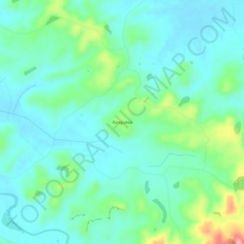
Name: Rangiatea topographic map, elevation, terrain.
Location: Rangiatea, Otorohanga District, Waikato, New Zealand (-38.23352 175.30620 -38.19352 175.34620)
Average elevation: 85 m
Minimum elevation: 53 m
Maximum elevation: 189 m