
O'Hare topographic map
Interactive map
Click on the map to display elevation.
About this map
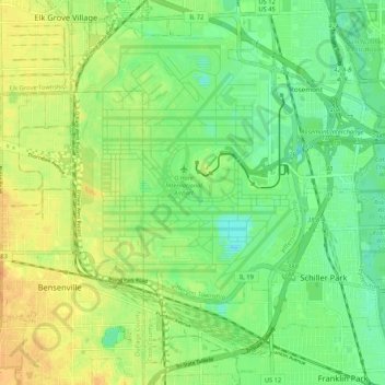
Name: O'Hare topographic map, elevation, terrain.
Location: O'Hare, Chicago, Cook County, Illinois, 60666, USA (41.93729 -87.94010 42.00890 -87.83479)
Average elevation: 200 m
Minimum elevation: 185 m
Maximum elevation: 216 m
Other topographic maps
Click on a map to view its topography, its elevation and its terrain.
Rogers Park
Rogers Park, Chicago, Cook County, Illinois, USA
Average elevation: 183 m
Garfield Ridge
Garfield Ridge, Chicago, Cook County, Illinois, USA
Average elevation: 184 m
Forest Glen
Forest Glen, Chicago, Cook County, Illinois, 60646, USA
Average elevation: 188 m