
Thank you for supporting this site ❤️
Make a donation
Make a donation
Reguengo topographic map
Click on the map to display elevation.
Thank you for supporting this site ❤️
Make a donation
Make a donation
About this map
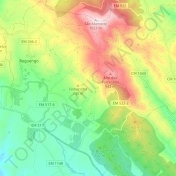
Name: Reguengo topographic map, elevation, terrain.
Location: Reguengo, Portalegre, Portugal (39.25614 -7.40459 39.32051 -7.32090)
Average elevation: 647 m
Minimum elevation: 399 m
Maximum elevation: 1,021 m
Thank you for supporting this site ❤️
Make a donation
Make a donation