
Thank you for supporting this site ❤️
Make a donation
Make a donation
Katuba topographic map
Click on the map to display elevation.
Thank you for supporting this site ❤️
Make a donation
Make a donation
About this map
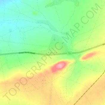
Name: Katuba topographic map, elevation, terrain.
Location: Katuba, Mkushi District, Central Province, Zambia (-13.69942 29.24393 -13.65942 29.28393)
Average elevation: 1,248 m
Minimum elevation: 1,191 m
Maximum elevation: 1,320 m
Thank you for supporting this site ❤️
Make a donation
Make a donation
Other topographic maps
Click on a map to view its topography, its elevation and its terrain.