
Oude God topographic map
Interactive map
Click on the map to display elevation.
About this map
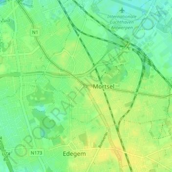
Name: Oude God topographic map, elevation, terrain.
Location: Oude God, Mortsel, Anvers, Flandre, 2640, Belgique (51.15043 4.43015 51.19043 4.47015)
Average elevation: 15 m
Minimum elevation: 5 m
Maximum elevation: 25 m
Other topographic maps
Click on a map to view its topography, its elevation and its terrain.