
Grindavíkurbær topographic map
Interactive map
Click on the map to display elevation.
About this map
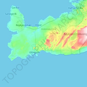
Name: Grindavíkurbær topographic map, elevation, terrain.
Location: Grindavíkurbær, Southern Peninsula, Iceland (63.79989 -22.71129 63.97776 -21.71365)
Average elevation: 41 m
Minimum elevation: -3 m
Maximum elevation: 548 m