
Las Aguilas topographic map
Interactive map
Click on the map to display elevation.
About this map
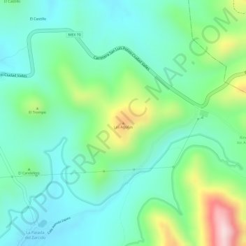
Name: Las Aguilas topographic map, elevation, terrain.
Location: Las Aguilas, Zaragoza, San Luis Potosí, México (22.09214 -100.68974 22.09224 -100.68964)
Average elevation: 2,160 m
Minimum elevation: 2,063 m
Maximum elevation: 2,387 m
Other topographic maps
Click on a map to view its topography, its elevation and its terrain.
Las Trojes
México > San Luis Potosí > Zaragoza
Las Trojes, Zaragoza, San Luis Potosí, México
Average elevation: 2,358 m
Villa de Zaragoza
México > San Luis Potosí > Zaragoza
Villa de Zaragoza, Zaragoza, San Luis Potosí, México
Average elevation: 2,027 m