
Weiskirchen topographic map
Interactive map
Click on the map to display elevation.
About this map
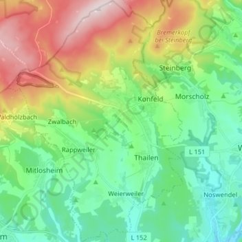
Name: Weiskirchen topographic map, elevation, terrain.
Location: Weiskirchen, Landkreis Merzig-Wadern, Saarland, 66709, Duitsland (49.50823 6.75730 49.59205 6.85135)
Average elevation: 399 m
Minimum elevation: 254 m
Maximum elevation: 699 m