
Fiume Melandro topographic map
Interactive map
Click on the map to display elevation.
About this map
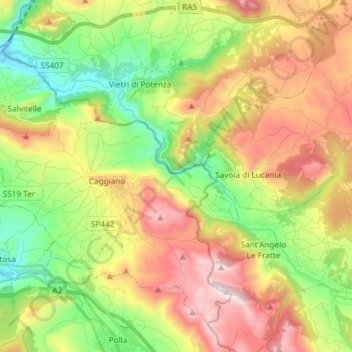
Name: Fiume Melandro topographic map, elevation, terrain.
Location: Fiume Melandro, Caggiano, SA, CAM, 85058, Italia (40.53005 15.44802 40.60854 15.59555)
Average elevation: 663 m
Minimum elevation: 200 m
Maximum elevation: 1,267 m