
Thank you for supporting this site ❤️
Make a donation
Make a donation
Poway topographic map
Click on the map to display elevation.
Thank you for supporting this site ❤️
Make a donation
Make a donation
About this map
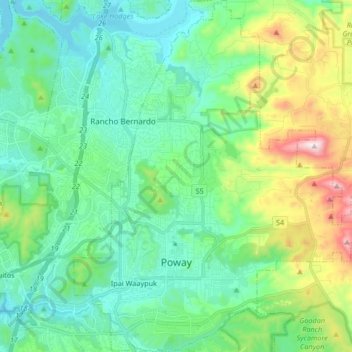
Name: Poway topographic map, elevation, terrain.
Location: Poway, San Diego County, California, 92064, United States (32.92717 -117.08431 33.06642 -116.94036)
Average elevation: 275 m
Minimum elevation: 86 m
Maximum elevation: 867 m
Thank you for supporting this site ❤️
Make a donation
Make a donation