
Pennington County topographic map
Interactive map
Click on the map to display elevation.
About this map
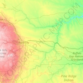
Name: Pennington County topographic map, elevation, terrain.
Location: Pennington County, South Dakota, USA (43.68494 -104.05545 44.50829 -102.00183)
Average elevation: 960 m
Minimum elevation: 553 m
Maximum elevation: 2,186 m
Other topographic maps
Click on a map to view its topography, its elevation and its terrain.