
Friedrichsgrün topographic map
Interactive map
Click on the map to display elevation.
About this map
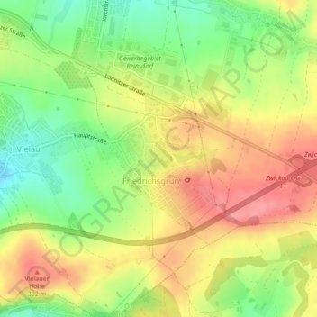
Name: Friedrichsgrün topographic map, elevation, terrain.
Location: Friedrichsgrün, Reinsdorf, Zwickau, Sachsen, Deutschland (50.67501 12.55352 50.68973 12.57440)
Average elevation: 361 m
Minimum elevation: 315 m
Maximum elevation: 402 m
Other topographic maps
Click on a map to view its topography, its elevation and its terrain.
Vielau
Deutschland > Sachsen > Reinsdorf
Vielau, Reinsdorf, Zwickau, Sachsen, 08141, Deutschland
Average elevation: 331 m