
Vasterival topographic map
Interactive map
Click on the map to display elevation.
About this map
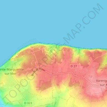
Name: Vasterival topographic map, elevation, terrain.
Average elevation: 37 m
Minimum elevation: 0 m
Maximum elevation: 101 m
Other topographic maps
Click on a map to view its topography, its elevation and its terrain.
Phare d'Ailly
France > Normandie > Seine-Maritime > Sainte-Marguerite-sur-Mer
Phare d'Ailly, Route du Sémaphore, Sainte-Marguerite-sur-Mer, Dieppe, Seine-Maritime, Normandie, France métropolitaine, 76119, France
Average elevation: 34 m
Fond de Saâne
France > Normandie > Seine-Maritime > Sainte-Marguerite-sur-Mer
Fond de Saâne, Sainte-Marguerite-sur-Mer, Dieppe, Seine-Maritime, Normandie, France métropolitaine, 76119, France
Average elevation: 22 m