
Thank you for supporting this site ❤️
Make a donation
Make a donation
Inglewood topographic map
Click on the map to display elevation.
Thank you for supporting this site ❤️
Make a donation
Make a donation
About this map
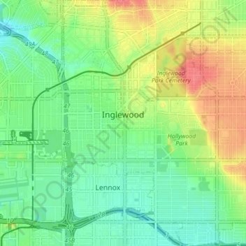
Name: Inglewood topographic map, elevation, terrain.
Location: Inglewood, Los Angeles County, California, United States (33.92518 -118.37885 33.98297 -118.31775)
Average elevation: 39 m
Minimum elevation: 14 m
Maximum elevation: 80 m
Thank you for supporting this site ❤️
Make a donation
Make a donation