
Thank you for supporting this site ❤️
Make a donation
Make a donation
Shasta County topographic map
Click on the map to display elevation.
Thank you for supporting this site ❤️
Make a donation
Make a donation
About this map
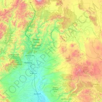
Name: Shasta County topographic map, elevation, terrain.
Location: Shasta County, California, United States (40.28542 -123.06906 41.18541 -121.31957)
Average elevation: 1,053 m
Minimum elevation: 68 m
Maximum elevation: 3,784 m
Thank you for supporting this site ❤️
Make a donation
Make a donation
Other topographic maps
Click on a map to view its topography, its elevation and its terrain.