
Tregaron topographic map
Interactive map
Click on the map to display elevation.
About this map
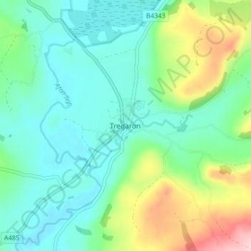
Name: Tregaron topographic map, elevation, terrain.
Location: Tregaron, Ceredigion, Pays de Galles, SY25 6HS, Royaume-Uni (52.20000 -3.95427 52.24000 -3.91427)
Average elevation: 210 m
Minimum elevation: 148 m
Maximum elevation: 380 m