
Santhià topographic map
Interactive map
Click on the map to display elevation.
About this map
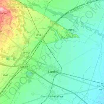
Name: Santhià topographic map, elevation, terrain.
Location: Santhià, Vercelli, Piemont, 13048, Italien (45.34409 8.12283 45.42894 8.27345)
Average elevation: 196 m
Minimum elevation: 159 m
Maximum elevation: 327 m
Der Ort liegt in der Po-Ebene auf einer Höhe 183 m s.l.m. etwa 20 km nordwestlich von Vercelli entfernt. Das Gemeindegebiet umfasst eine Fläche von 53 km². Die Nachbargemeinden sind Alice Castello, Carisio, Casanova Elvo, Cavaglià, Crova, Formigliana, San Germano Vercellese und Tronzano Vercellese.
Other topographic maps
Click on a map to view its topography, its elevation and its terrain.
Borgosesia
Italien > Piemont > Vercelli > Borgosesia
Borgosesia, Vercelli, Piemont, 13011, Italien
Average elevation: 608 m