
Rothenberg topographic map
Interactive map
Click on the map to display elevation.
About this map
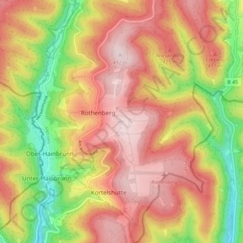
Name: Rothenberg topographic map, elevation, terrain.
Location: Rothenberg, Oberzent, Odenwaldkreis, Hessen, Duitsland (49.47055 8.89718 49.52343 8.95789)
Average elevation: 344 m
Minimum elevation: 145 m
Maximum elevation: 499 m
Other topographic maps
Click on a map to view its topography, its elevation and its terrain.
Ernsbach
Duitsland > Hessen > Odenwaldkreis
Ernsbach, Erbach, Odenwaldkreis, Hessen, 64711, Duitsland
Average elevation: 447 m