
IS topographic map
Interactive map
Click on the map to display elevation.
About this map
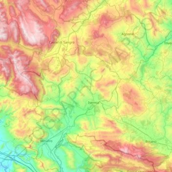
Name: IS topographic map, elevation, terrain.
Location: IS, Molise, Italien (41.38743 13.94102 41.91176 14.52225)
Average elevation: 886 m
Minimum elevation: 16 m
Maximum elevation: 2,273 m
Other topographic maps
Click on a map to view its topography, its elevation and its terrain.