
Comuna Sur topographic map
Interactive map
Click on the map to display elevation.
About this map
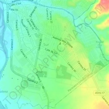
Name: Comuna Sur topographic map, elevation, terrain.
Location: Comuna Sur, Neiva, Huila, 0001, Colombia (2.88599 -75.29065 2.92082 -75.25661)
Average elevation: 458 m
Minimum elevation: 433 m
Maximum elevation: 510 m
Other topographic maps
Click on a map to view its topography, its elevation and its terrain.
Jardín Botánico
Colombia > Huila > Comuna Sur
Jardín Botánico, Puertas del Sol, Comuna Sur, Neiva, Huila, Colombia
Average elevation: 463 m