
La Bessaire topographic map
Interactive map
Click on the map to display elevation.
About this map
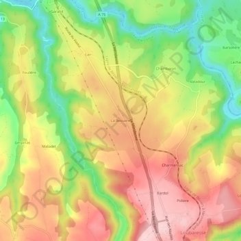
Name: La Bessaire topographic map, elevation, terrain.
Average elevation: 849 m
Minimum elevation: 729 m
Maximum elevation: 953 m
Other topographic maps
Click on a map to view its topography, its elevation and its terrain.
Le Chassan
France > Auvergne-Rhône-Alpes > Cantal > Val d'Arcomie > Faverolles
Le Chassan, Faverolles, Val d'Arcomie, Saint-Flour, Cantal, Auvergne-Rhône-Alpes, Metropolitan France, 15320, France
Average elevation: 882 m
La Roche
France > Auvergne-Rhône-Alpes > Cantal > Val d'Arcomie > Saint-Marc
La Roche, Saint-Marc, Val d'Arcomie, Saint-Flour, Cantal, Auvergne-Rhône-Alpes, Metropolitan France, 15320, France
Average elevation: 954 m