
Coria topographic map
Interactive map
Click on the map to display elevation.
About this map
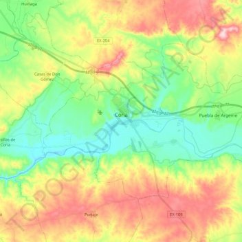
Name: Coria topographic map, elevation, terrain.
Location: Coria, Vegas del Alagón, Cáceres, Estrémadure, 10800, Espagne (39.92805 -6.60423 40.02967 -6.39768)
Average elevation: 306 m
Minimum elevation: 212 m
Maximum elevation: 444 m