
Yushu City topographic map
Interactive map
Click on the map to display elevation.
About this map
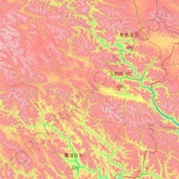
Name: Yushu City topographic map, elevation, terrain.
Location: Yushu City, Yushu Tibetan Autonomous Prefecture, Qinghai, PRC (32.02753 95.68113 33.76366 97.73058)
Average elevation: 4,490 m
Minimum elevation: 3,494 m
Maximum elevation: 5,589 m
Other topographic maps
Click on a map to view its topography, its elevation and its terrain.
Darlag County
Darlag County, Golog Tibetan Autonomous Prefecture, Qinghai, PRC
Average elevation: 4,391 m