
La Puerta topographic map
Interactive map
Click on the map to display elevation.
About this map
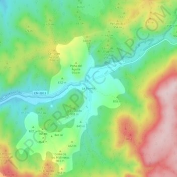
Name: La Puerta topographic map, elevation, terrain.
Location: La Puerta, Trillo, Guadalajara, Castilla-La Mancha, España (40.61544 -2.60942 40.65544 -2.56942)
Average elevation: 893 m
Minimum elevation: 752 m
Maximum elevation: 1,109 m