
Kwun Tong Promenade topographic map
Interactive map
Click on the map to display elevation.
About this map
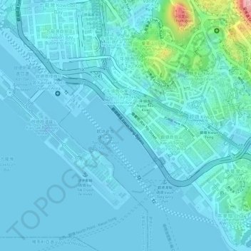
Name: Kwun Tong Promenade topographic map, elevation, terrain.
Average elevation: 21 m
Minimum elevation: -23 m
Maximum elevation: 186 m
Other topographic maps
Click on a map to view its topography, its elevation and its terrain.
Sau Mau Ping Memorial Park
Sau Mau Ping Memorial Park, Kwun Tong, Sau Mau Ping, Kwun Tong District, Hong Kong, PRC
Average elevation: 102 m