
Cururupare topographic map
Interactive map
Click on the map to display elevation.
About this map
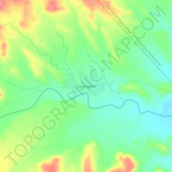
Name: Cururupare topographic map, elevation, terrain.
Average elevation: 328 m
Minimum elevation: 295 m
Maximum elevation: 381 m
Other topographic maps
Click on a map to view its topography, its elevation and its terrain.
Pedregal
Venezuela > Estado Falcón > Municipio Democracia
Pedregal, Parroquia Pedregal, Municipio Democracia, Estado Falcón, Venezuela
Average elevation: 226 m