
Thank you for supporting this site ❤️
Make a donation
Make a donation
Takachiho topographic map
Click on the map to display elevation.
Thank you for supporting this site ❤️
Make a donation
Make a donation
About this map
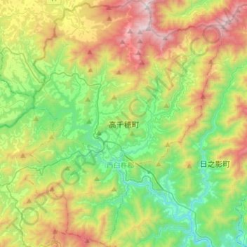
Name: Takachiho topographic map, elevation, terrain.
Location: Takachiho, Nishi-Usuki County, Miyazaki Prefecture, Japan (32.62884 131.22611 32.83359 131.42155)
Average elevation: 672 m
Minimum elevation: 82 m
Maximum elevation: 1,718 m
Thank you for supporting this site ❤️
Make a donation
Make a donation